
The range of Ochil Hills dominate the northern third of the county, where Clackmannanshire's highest point, Ben Cleuch, with its summit at 721 metres (2365 feet), can be found. The northernmost area of the county lies along the Upper Glendevon Reservoir. Strathdevon is immediately to the south of the steep escarpment formed by the Ochil Fault, along which the Hillfoots villages of Menstrie, Alva, Tillicoultry, Dollar and Muckhart are located.
Strathdevon mostly comprises a lowland plain a few hundred metres either side of the river Devon, which joins the River Forth on the southern edge of the county near the village of Cambus. From its source in the Ochil Hills, it flows 33 miles below the hills and down to the River Forth, though still just 5¼ miles from its source as the crow flies. From its source in the Cleish hills in Fife, the Black Devon river flows westwards almost parallel to the Devon past the town of Clackmannan to join the River Forth near Alloa. Roughly in the centre of the county lies the Gartmorn Dam Country Park and Nature Reserve, and there are small patches of forest located throughout the county. Two peninsulas are formed by meanders in the river Forth along Clackmannanshire's southern boundary; the easternmost of these has two small islands - Tullibody Inch and Alloa Inch - either side of it.
The Ochil Hills
The Ochils are formed from a thick wedge of Devonian age (358 to 419 million year old) volcanic and volcano-sedimentary rocks, rising up from below the lower Old Red Sandstone sedimentary rocks to the north and terminated to the south by the major southerly Ochil Fault Escarpment.
The Ochil Volcanic Formation consists of basaltic andesite and trachyandesite lavas and related rock types erupted during the Early Devonian period. Parts of the lower slopes on the northern side around Blackford and Auchterarder in Perthshire are formed from a volcanic conglomerate. The whole area is heavily faulted with some valleys such as Alva Glen and Glen Sherup having been eroded from the rock. Glacial till covers much of the lower ground around and within the range and peat accumulations occur on the plateau surface, particularly to the west in Stirlingshire.
With just 35,160 acres (55 square miles), Clackmannanshire is the smallest county not only in Scotland, but the United Kingdom as a whole.
The Forth river is navigable by small craft as far as it forms the boundary of the county, and ships of up to 500 tons of cargo used to stop at Alloa Dock, however the dock is no longer in service.
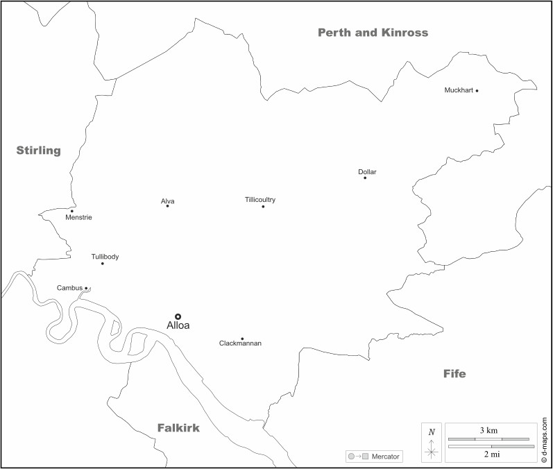
Clackmannanshire map from d-maps.com
References:
Wikipedia
Statistical Account of Scotland
New Statistical Account of Scotland