
NCN 764 is a paved pedestrian and cycle route from Dunfermline, Fife, to Alloa, Clackmannanshire, in Scotland. For much of its distance the route follows the track bed of the former Dunfermline to Alloa Railway, but only as far as Clackmannan. After this point the railway is back in use for rail freight traffic. The NCN 764 route continues from Clackmannan into Alloa town centre by roads and pathways, where it links up with more of the county's cycle routes.
The Dunfermline to Alloa Railway opened in 1850, with the line running from Dunfermline Upper Station (now a retail park) to Alloa Station (now a disused leisure centre) and was extended through to Stirling by 1852. The route was closed to passengers in 1968. The Kincardine Junction to Oakley Station section closed completely in 1979, and the last sections of the railway were lifted in 1987 with the closing of Comrie Colliery at the end of 1986. There still remains some traces of its railway past along the route, which makes this reasonably flat countryside route all the more interesting.
The former rail section of the cycle route, also known as the West Fife Cycle Way (WFCW) and Clackmannan Way, stretches for 17.5 kilometres (10.9 miles). The full route from Clackmannan to Dunfermline is tarmac paved with grass or ballast verges and provides an excellent all-weather surface.
In Dunfermline the route begins at the William Street car park on the outskirts of the town.
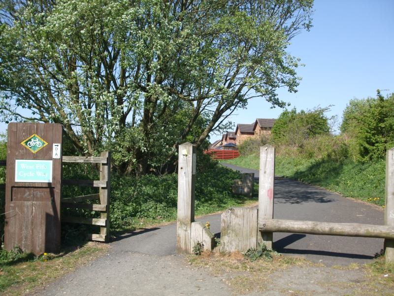
The beginning of the WFCW at Dunfermline
The beginning of the cycle route skirts along the back of the houses on the right for a few hundred metres from where you can see the Forth bridges in the distance on the left. The path soon opens out to a width which becomes the norm for the rest of the route.
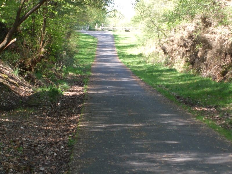
The path climbs gently until it goes under the first bridge at Milesmark, just after the former Whitemyre Junction then a gradual descent leads down towards Oakley through open countryside.
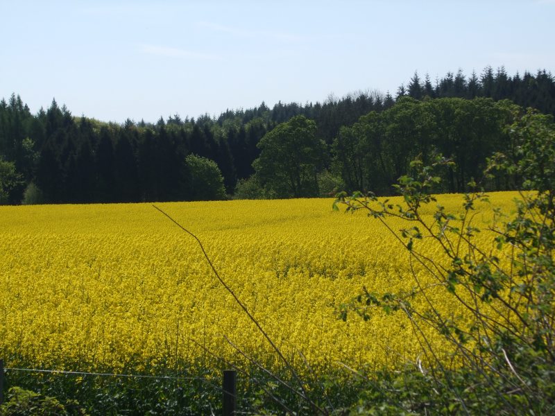
Open countryside views are available between Dunfermline and Oakley
The next point of interest is at Oakley where some remnants of the former Oakley Railway station, marshalling yard and the branch for Comrie Colliery were situated. The WFCW then goes into shallow cuttings to cross over the Bluther Burn on the Comrie Dean Viaduct. At the Eastern end of the viaduct at Blairhall Junction is another path which marks the branch to Blairhall Colliery (closed 1969).
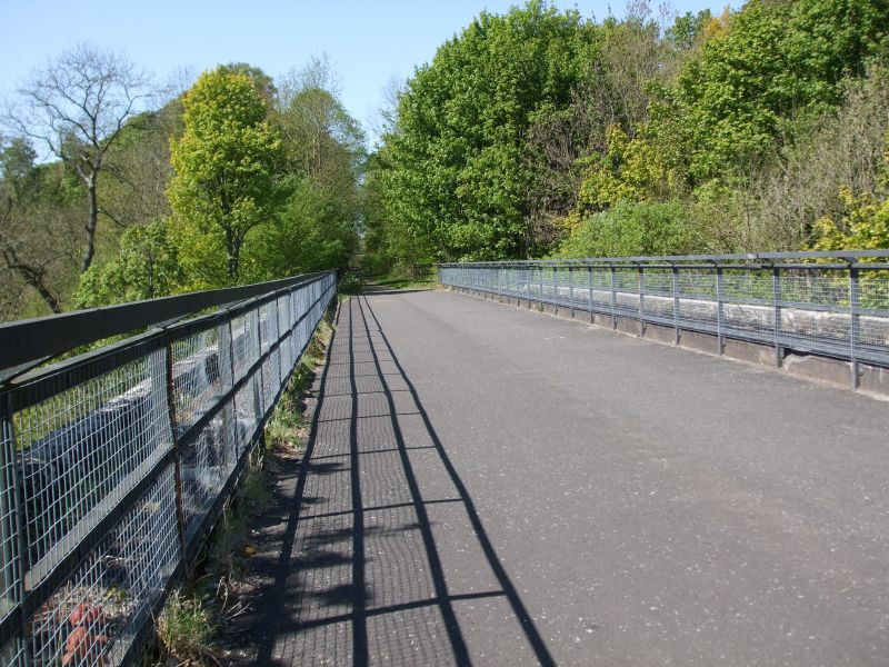
The Comrie Dean Viaduct from the East end at Blairhall Junction.
The countryside opens out after the cuttings at the west end of the viaduct before the route enters the edge of Devilla Forest. On the right is the former Bogside Colliery (closed 1985), which was one of the mines which once formed part of the Longannet coal mining complex, feeding coal into the (now demolished) Longannet Power Station.
The WFCW is crossed by a farm road and access points have been erected on either side of this road. The route ramps from track to road level on either side of this road.
Ramp up to the farm road from the East
Bogside Station and Signal Box is just after the access points, the signal box has been made secure while the station has been incorporated into the sawmill opposite. The wooden Alloa bound waiting room still exists in a poor state amongst the bushes.
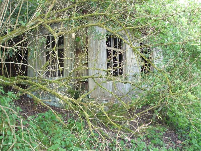
The Alloa-bound waiting room still exists amongst the bushes
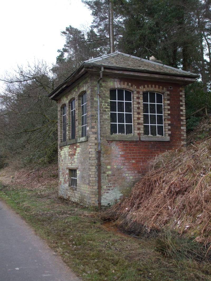
Bogside station's signal box is the most intact rail building along the route
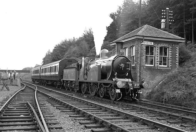
Bogsie when in use - internet picture.
The end of the WFCW part of this route is at a place called Slack. There are only about two or three buildings in the area, and one is called Slack Cottage. There is a small car park here and another access point, which marks the end of the Fife section of the cycle way.
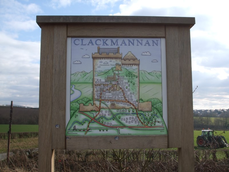
The Clackmannan Way takes over on this route after the access point. This is marked by a sign with a stylised map and Sponsor / stakeholder logos, and a noticeable change in the type of tarmac used to pave the route.
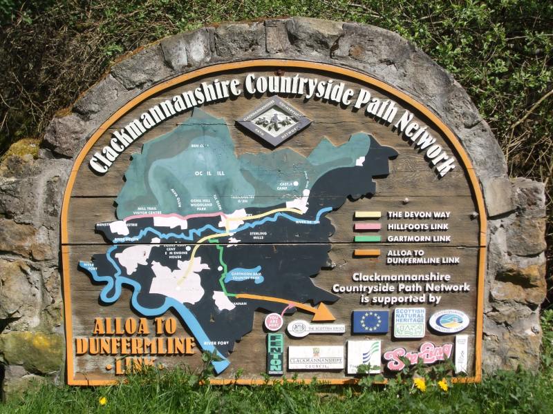
Sign at the east end of the Clackmannanshire stretch of NCN 764
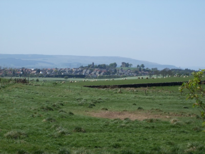
The route then passes through a wood before entering the open countryside for a brief period, where Clackmannan can be seen in the distance to the left.
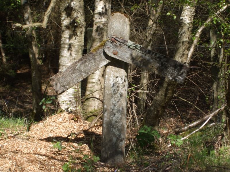
Gradient post about 1km east of Forestmill Station
The way then crosses over the A977 near the site of the former Castlebridge Colliery at Forestmill Station (Closed circa 1955), before re-entering the woods. Soon after this, overhead power lines feeding the Castlebridge industrial site from Alloa become a feature of the cycleway, with the route meandering in places around the posts.
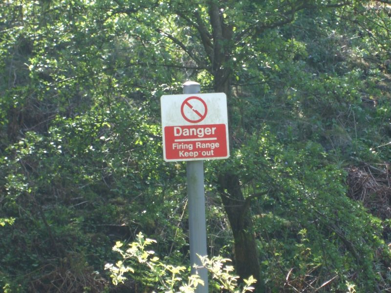
Just after this Keep Out notices are posted at regular intervals along the south side of the route, as the local shooting club has their range nearby.
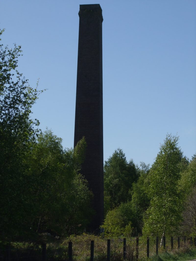
The next point of interest is the derelict Cherryton Brickworks. It is situated alongside the route, with the brick-built square chimney clearly visible. The chimney and some of the kilns are quite close the to the fence.
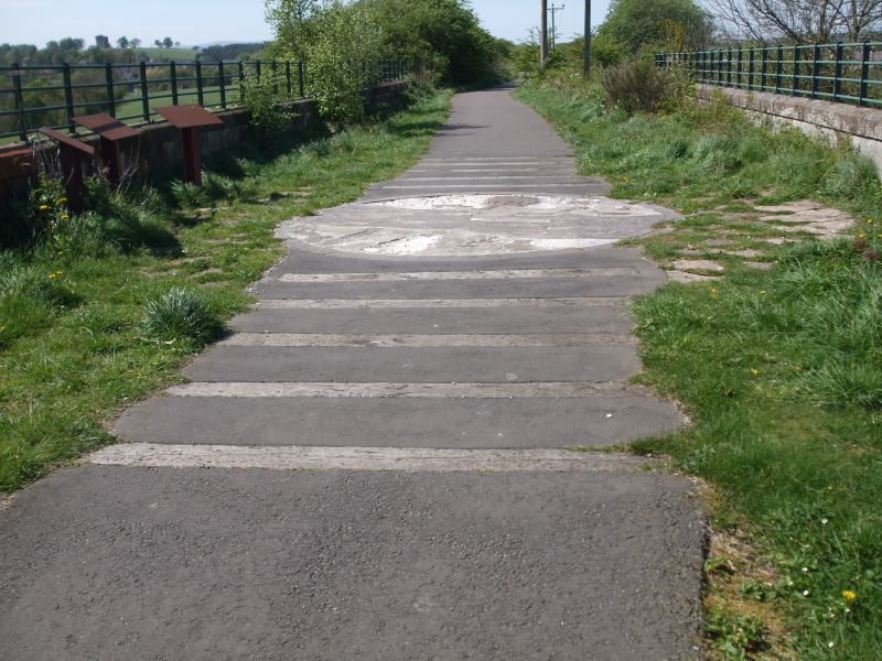
Continuing from the brickworks, the route crosses over the river Black Devon by another viaduct. A piece of artwork can be seen embedded in the paved surface on the mid point of the bridge. It is now in need of repair, but still clearly shows the rails crossing over a river full of fish.
Just after where the former Clackmannan Road Station was once situated, a viaduct crosses over the B910 to end at a gate.
Signpost at the Clackmannan stage of the route shows the cycle route through the town, starting bottom left
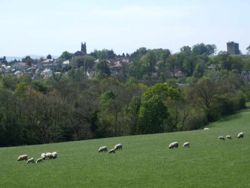
Clackmannan from the cycleway. Clackmannan Tower is visible on the right of the picture.
Just before the gate at the end of the rail section of the cycleway, turn right and down the embankment to an access point and turn right signposted for Gartmorn Dam or turn left then immediately right at the B910 and follow the road into Clackmannan where the NCN 764 will head for Alloa.
If you can send us pictures from the route in its past or present use, please do so.